
June 4, 2025, 2:57 pm | Read time: 5 minutes
The Canary Islands are known for their beautiful beaches, guaranteed sunshine, and unique natural landscapes. However, they are also a popular destination for many hikers. Whether it’s short walks or long-distance treks, the islands can be explored in a variety of ways. TRAVELBOOK author Frank Lehmann laced up his hiking boots on several of them and shares his top tips. In Part 3, he heads to La Palma!
La Palma, known as “La Isla Bonita,” offers a unique variety for hiking enthusiasts with its dense laurel forest, volcanic landscapes, and breathtaking coastal paths. The well-developed network of hiking trails makes the island ideal for both leisurely walks and challenging tours. These are my personal highlights for hiking on La Palma.
Overview
Start of the Journey in Santa Cruz de la Palma
After a week on La Gomera, it’s time to say goodbye—about 90 kilometers away, La Palma can already be glimpsed. The fast ferry covers the distance from San Sebastian in two hours—and soon the catamaran sets off with us to the third island. Here again the same luxury problem: hundreds of great hikes pop up in the Komoot app.
We sort our plans in the cozy cafes of Santa Cruz de la Palma. It’s worth staying for two nights here. Centuries-old architecture, cobblestone streets, small museums, and a fine black beach. Occasionally, a cruise ship unloads its visitors into the old town for a few hours, but the crowds quickly disperse. Then the Canary city reveals itself as a lively and authentic place, belonging not to tourists but to Spaniards. Three tips:
- Visit the maritime museum, located in a replica of the Santa Maria, Columbus’ sailing ship.
- Drink fresh sugarcane juice at the Mercado Municipal.
- Admire the town hall at Plaza de España not only from the outside but go inside and explore the historic halls.
Off We Go in La Nieves Nature Park
Enough resting, we head to the northeast to La Nieves Nature Park. The Los Tilos Biosphere Reserve beckons with vast forests. The laurel forests are protected and steaming with moisture. A third of the island is forested, and around the community of Los Sauces, you are surrounded not only by banana plantations but especially by extensive primeval forests.
If Los Tilos is closed due to bad weather, the hike from La Galga is just as beautiful. Through the deep green forest, we ascend to the Mirador de Somada Alta. It takes us four hours to cover 12 kilometers and 400 meters of elevation change. In La Galga, there’s also a tiny visitor center where you can get fascinating information. “What are your two favorite hikes on the island?” I ask the staff there. Of course, she first recommends the hikes in Caldera de Taburiente National Park. But her insider tip is to walk away from the crowds and explore parts of the GR 130 Camino Real de las Costa long-distance trail in the north. There, it’s lonely and spectacular, always along the cliffs by the rugged Atlantic. My personal two tips for hiking in the north of La Palma: free swimming in the sea pools Piscinas de La Fajana and El Charco Azul. It’s also worth visiting the Parque Arqueológico El Tendal Museum—there are exciting tours about the history of the indigenous people.
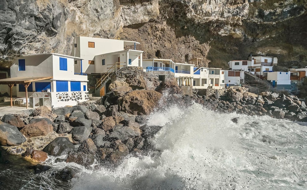
Hike to the Fishing Village Poris de la Candelaria
Unfortunately, we don’t have time for long-distance hikes, so today we only have time for the 5-hour hike to the village of Cueva de Poris de la Candelaria. We start in Tijarafe, and from there, it’s a 650-meter descent to the Atlantic and later back up, as no bus runs here. Poris de la Candelaria is a tiny fishing village in a storm-battered huge cave. In the past, smugglers and pirates lived here.
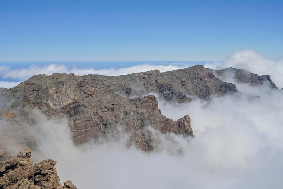
Then we head to Caldera de Taburiente National Park. A huge, semicircular erosion crater with a circumference of 28 kilometers awaits us there. A must is the hike deep down in the crater in Barranco de las Angustias to the Cascada de Colores waterfall. That’s what we were told, but we couldn’t get in: once again, the path was closed due to heavy rain. But the alternatives are countless. With a rental car, we drive up to the summit Roque de los Muchachos at 2,426 meters altitude. Here you can wonderfully walk along the crater rim to Pico de la Cruz and have breathtaking views into the depths.

The Most Beautiful Hiking Trails on La Gomera

This Seaside Resort on Tenerife Is Still a Hidden Gem

The best tips for a vacation on Lanzarote
Ruta de los Volcanes on La Palma
My absolute favorite is the Ruta de los Volcanes—a 18.7-kilometer high-altitude trail that runs along the ridge of Cumbre Vieja. The start is at Refugio del Pilar, then we hike high above the clouds. Along numerous volcanic craters, it goes to the village of Fuencaliente. Here you can spend the night and then head to Volcán de Teneguía. If you want, you can also have a lazy beach day and go to Puerto Naos on the black sand beach. We decided against it and instead put on our boots to walk through the volcanic landscape down to the salt flats of Fuencaliente. The famous Flor de Sal is harvested there. The two lighthouses on site are a wonderful photo opportunity. Buses run regularly from there back up, making the return trip easy.
From Santa Cruz, there are good flight connections back to Germany. The three weeks are over, and home calls. What was now the most beautiful, best hiking island—Tenerife, La Gomera, or La Palma? My answer: all three! Lonely gorges, bizarre volcanic landscapes, steep cliffs, mystical fog forests, and charming villages. You find that on each one. If you appreciate a bit more hustle and very high mountains, head to Tenerife. La Gomera is more charming and relaxed. And La Palma rightly earns its nickname: “La Isla Bonita,” the beautiful island that enchants everyone.