

July 6, 2026, 5:04 am | Read time: 5 minutes
In May 1980, Mount St. Helens in Washington state erupted catastrophically. It resulted in one of the largest natural disasters in American history, claiming 57 lives and even darkening the sun. It was also the most expensive volcanic eruption in the continent’s history, causing damage valued at well over a billion dollars at the time. Since then, scientists have closely monitored the volcano, as it remains active.
It is May 18, 1980, 8:32 a.m. local time, when the apocalypse strikes in southern Washington state. At least, that’s how it must have seemed to people back then. At that moment, the entire northern flank of Mount St. Helens begins to slide. Weeks earlier, since March 1980, there had been signs that a disaster might soon occur. However, no one anticipated its actual magnitude. In the end, help comes too late for 57 people. Five hundred square kilometers of nature are completely devastated and partially buried under a layer of ash, mud, and debris up to 180 meters thick. It remains the most economically devastating volcanic eruption in U.S. history.
According to the Geological Society of America, signs first appeared on March 20, 1980, that Mount St. Helens might be active again. The first records of eruptions date back 300,000 years, followed by dormant periods lasting up to 15,000 years. But now the earth is shaking. In just two months leading up to the final catastrophe, more than 10,000 smaller earthquakes occur. Additionally, a bulge over 1.6 kilometers in diameter forms on the volcano’s northern flank due to underground magma flows, expanding by nearly two meters daily. On March 27, Mount St. Helens, named after an English baron, emits steam and ash for the first time.
Largest Recorded Landslide
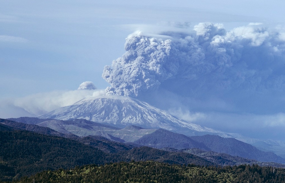
Authorities immediately begin evacuating the sparsely populated region around the volcano. Yet, at this point, no one suspects how catastrophic the final eruption of Mount St. Helens on May 18, 1980, will be. Early that morning, an earthquake with a magnitude of 5.1 on the Richter scale occurs. Within minutes of this tremor, the entire northern flank of the volcano begins to collapse in the largest recorded landslide. According to the Encyclopedia Britannica, the avalanche of rock, accompanied by a laterally escaping gas cloud at 350 degrees Celsius, reaches speeds of up to 500 kilometers per hour.
Also of interest: Masaya: The Volcano That Converted a Country to Christianity
The pyroclastic flow from Mount St. Helens buries valleys and rivers within a 27-kilometer radius under a debris layer up to 180 meters thick. Simultaneously, a cloud of gas and ash rises from the volcano, reaching 27 kilometers into the sky. Spokane, 400 kilometers from the disaster site, reports a complete darkening of the sky. Five hundred twenty million tons of ash are blown into the air, spreading over nearly 57,000 square kilometers across the United States. Within three days, the ash covers the entire U.S., and after 15 days, it can be detected around the globe.
Unimaginable Destruction

The lateral gas escape at Mount St. Helens fells an estimated 10 million trees with its shockwave. An area of 500 square kilometers of nature is completely devastated. Ice and snow, melted by the eruption’s heat, mix with rock to form mudslides. Two hundred houses are destroyed, and 57 people lose their lives in the disaster. It also destroys nearly 300 kilometers of roads, about 24 kilometers of rail network, and 27 bridges. Millions of animals, most of them fish, also perish in the eruption. Astonishingly, the mountain causes all this destruction in just nine hours. By the next day, it has ceased its activity for the time being.
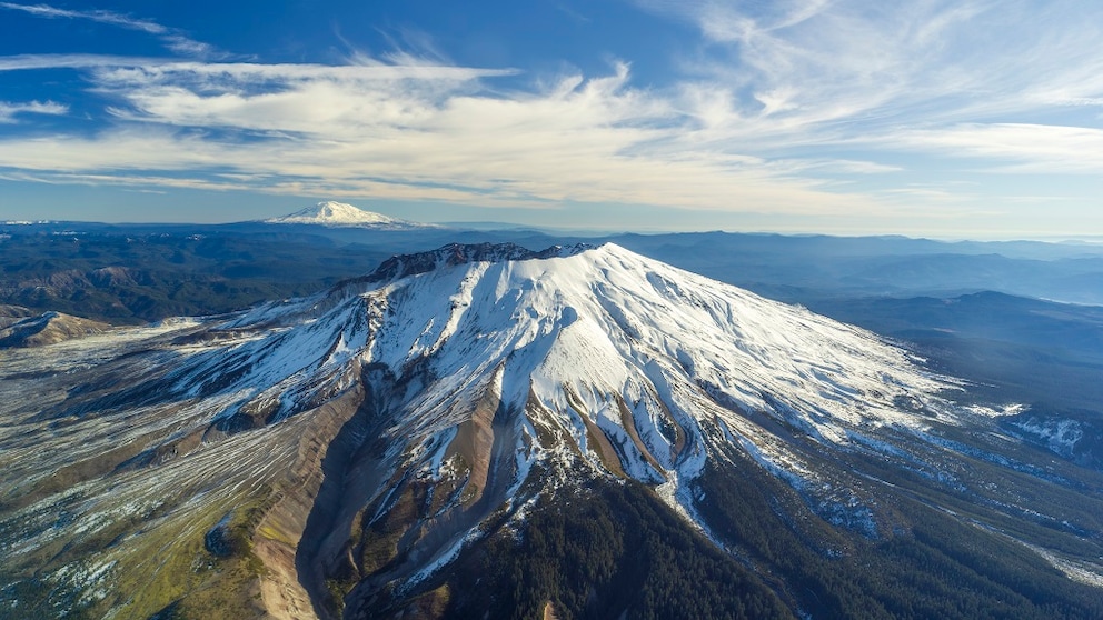
Mount St. Helens itself does not survive the day unscathed. The landslide reduces its original height by more than 400 meters. Previously measuring 2,950 meters, it stands at only 2,549 meters once the dust settles. Two years after the tragedy, the U.S. government designates a 445-square-kilometer area around the volcano as a national monument and thus a protected zone. Scientists continue to research the volcano there, as it is still considered active. Visitors can view the mountain from the Johnston Ridge Observatory, where they can see the crater, lava dome, and the plain where the unprecedented tragedy occurred. To this day, the eruption of Mount St. Helens remains the most economically devastating in U.S. history.
According to an official document from the U.S. Government Accountability Office, the U.S. Senate approved $946 million at the time to address the long-term damage from the volcanic eruption. Other sources online even mention damages of up to $1.8 billion caused by Mount St. Helens. Adjusting these amounts for today’s value, inflation brings the total to nearly four times as much. According to the Mount St. Helens Science & Learning Center, the National Forest Service has replanted about 5,665 hectares around the former disaster area with ten million conifers. Scientists estimate that a similarly devastating eruption is not currently expected in the near future.